
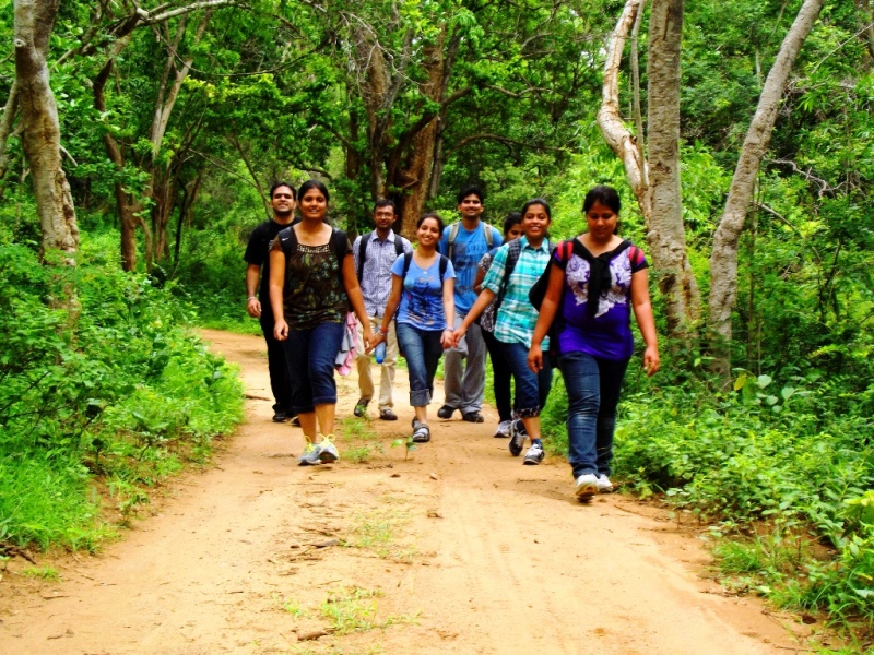
Below is the list for the best one day and short treks near Bangalore within 100 to 200 Kms from Bangalore. These treks can be covered in a single day and night trek can also be attempted on these treks.
Page Contents
Best spots for Trekking near Bangalore (Short Treks):
[su_table]
| Trek Name | Distance from Bangalore | Trek Length | Time to trek | Difficulty level | Permission required? | Guide required? |
| Anthargange Trek | 70 Km | 4 Km | 2 Hours | Easy | No | No |
| Skandagiri trek | 65 Km | 3 Km | 2 Hours | Easy | Banned | Banned |
| Makalidurga Trek | 60 Km | 5 Km | 2 Hours | Easy | No | Yes |
| Revana Siddeshwara betta Trek | 60 Km | 1 Km | 30 min | Easy | No | No |
| Kabbaladurga Trek | 80 Km | 3 Km | 2 Hours | Easy-Medium | No | No |
| Ramadevara betta Trek | 60 Km | 2 Km | 1 Hour | Easy | No | No |
| Bheemeshwari Trek | 110 Km | 3 Km | 2 Hours | Easy | Yes | Yes |
| Bilikal Rangaswamy Trek | 70 Km | 5 Km | 3 Hours | Medium | No | Yes |
| Savandurga Trek | 60 Km | 4 Km | 2 Hours | Easy-Medium | Yes | Yes |
| Kunti Betta Trek | 100 Km | 2 Km | 1 Hour | Easy | No | No |
| Devrayanadurga Trek | 70 Km | 1 Km | 30 min | Easy | No | No |
| Madhugiri Trek | 120 Km | 2 Km | 1.5 Hours | Easy | No | No |
| Nandi hills trek Trek | 90 Km | 2 Km | 1 Hours | Easy | No | No |
| Siddara trek Trek | 100 Km | 2 Km | 1 Hours | Easy | No | No |
| Shivgange trek Trek | 50 Km | 2 Km | 1 Hours | Easy | No | No |
[/su_table]
Trekking near Bangalore (long Treks):
[su_table]
| Trek Name | Distance from Bangalore | Trek Length | Time to trek | Difficulty level | Permission required? | Guide required? |
| Kodachadri Trek | 420 Km | 10 Km | 6 Hours | Medium-hard | No | No |
| Kumara Parvatha trek | 300 Km | 15 Km | 8 Hours | Hard | Yes | No |
| Tadiandmol Trek | 275 Km | 6 Km | 4 Hours | Easy-medium | No | No |
| Bandaje Arabi falls Trek | 310 Km | 25 Km | 10 Hours | Medium-hard | Yes | Yes |
| Nishani Motte Trek | 300 Km | 12 Km | 8 Hours | Medium | Yes | Yes |
| Narasimha Parvatha Trek | 360 Km | 13 Km | 8 Hours | Hard | Yes | Yes |
| Sakleshpur Railway Trek | 225 Km | 21 Km | 9 Hours | Medium-hard | Banned | Banned |
| Dudhsagar Falls Trek | 600 Km | 15 Km | 7 Hours | Medium | No | No |
| Kudremukh Trek | 330 Km | 9 Km | 5 Hours | Medium | Yes | Yes |
| Mullayanagiri Trek | 300 Km | 12 Km | 7 Hours | Medium | Yes | No |
| Gokarna Beach Trek | 500 Km | 12 Km | 6 Hours | Easy | No | No |
| Ombattu Gudda Trek | 260 Km | 24 Km | 10 Hours | Hard | Banned | Banned |
| Agumbe Trek | 360 Km | 13 Km | 8 Hours | Hard | Yes | Yes |
[/su_table]
-
Bheemeshwari Trek from Bangalore
Distance from Bangalore: 110 Kms
Bheemeshwari is one of the most famous wildlife places to visit near Bangalore. It is famous for fishing camps, rafting, cottage stay etc. Below is some more information about Bheemeshwari.
What to do in Bheemeshwari?
- Fishing at Galibore fishing camp; Rafting and night stay at Bheemeshwari Jungle lodges and adventure camps which require pre-booking (can be done online too)
- Coracle ride
- River-side trek or Jungle trek in Muthathi (It requires permission from Muthathi forest department)
- Sangama is almost 50 Kms from Bheemeshwari and is a beautiful place too. As the name suggests, two rivers meet there.
How to organize Bheemeshwari trek?
- Go to Muthathi forest range office. You can ask anyone they will guide you.Talk with them and negotiate for the price
- They will assign you a guide
- Tell them before hand what kind of trek you are interested in, river-side along Kaveri or jungle trek
Can I pitch my own tent there overnight?
Of course. Initially, they might not allow you to pitch tent riverside but inside forest department compound, you can stay overnight. Make sure you talk to them beforehand.

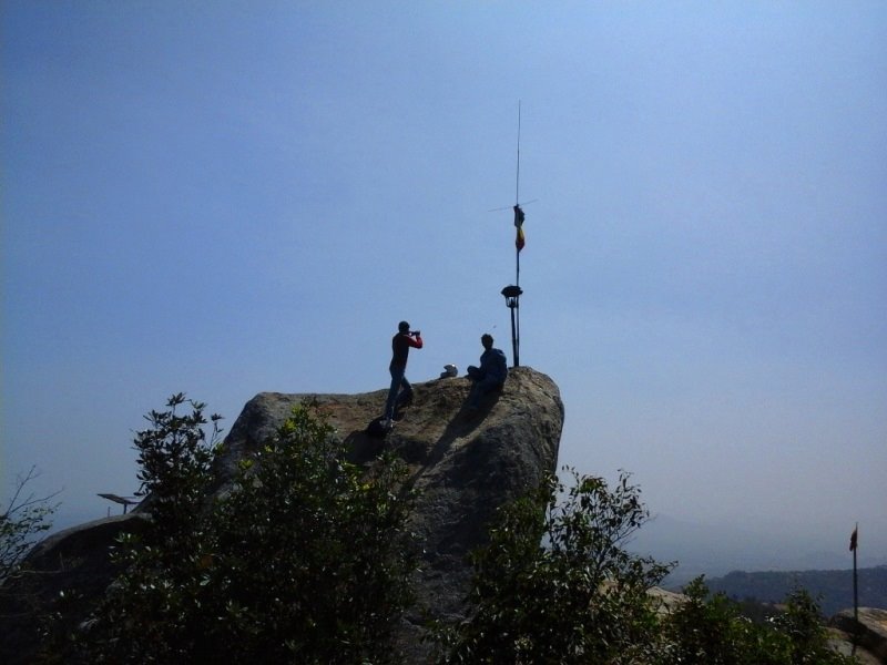
Distance from Bangalore: 70 Kms
Skandagiri trek is one of the nearest places for trekking near Bangalore. This trekking spot near Bangalore is famous for mostly night treks.
How to reach Skandagiri?
If you have your own vehicle, Google map can show you the way or you can call a private cab. Refer the get details map below
Best time to visit: Throughout the year, winter is the best choice to go there (Don’t forget woolens in winters :))
What to see and do there?
- Enjoy dews formed over grasses, cold wind piercing through woolens, clouds hanging down the hill, mesmerizing sunrise, tall trees appearing black and white at morning.
- If you love photographing, its a paradise for you. Sometimes, you might encounter wild rare flowers of western ghats beside your shoe.

Sunrise, Nandi Hills
Distance from Bangalore: 50 Kms
Nandi hills, until now, was on the list of places to visit around Bangalore. But in the recent times, trekking has also started at the Nandi hills from the main road below.
How to reach Nandi hills?
If you have your own vehicle, Google map can show you the way or you can call a private cab. They have different packages for Nandi Hills.
Best time to visit: Throughout the year, winter is the best choice to go there (Don’t forget woolens in winters :))
Timings: 6 AM to 9 PM
What to see and do there in Nandi Hills?
- Enjoy dews formed over grasses, cold wind piercing through woolens, clouds hanging down the hill, mesmerizing sunrise, tall trees appearing black and white at morning.
- If you love photographing, it’s a paradise for you. Sometimes, you might encounter wild rare flowers of western ghats beside your shoe.
- Walk along hill and fort’s wall perimeter for more awesome views
Note: Leave Bangalore around 4’o clock. On weekends, you might encounter a long queue of vehicles at forest checkpoint because they allow entry at 6’o clock. So be first to reach early.

Distance from Bangalore: 80 Kms
Trek distance: 2-3 Kms
Level: Easy to Medium
Kabbal durga trek always makes it to the list of short trekking spots near Bangalore. It is one day trek. And like, Skandagiri trek, people also like to go here for the night trek.
What to see?
- There is a temple of Kabbalamma at the top. Enjoy the surrounding sitting at the top like a hawk. Other than that, Steep monolithic rocks, Abandoned rock house, old water pool, mesmerizing view from the top.
- Best time to visit: Day trek can be done in any time of the year but steep rocks can become slippery if attempted during the night

Kunti Betta trek is near Pandavpura on the way from Bangalore to Mysore. It is also famous as a night trekking places around Bangalore.
How to reach Kunti Betta?
From Pandavpura, Kunti Betta is just 4 Kms, you will have to ask the route.
Best time to visit: Go for night trek throughout the year
What to see?
- Remote villages of Karnataka from summit
- Tonnuru lake from the hill top
- Ancient temples
- Jaggery on the way
- Greenery on the way
Where else can I cover around Kunti Betta?
- Brindavan Garden
- Mysore city
- Tonnuru Kere: A freshwater lake (Bathing and swimming is allowed)
Rangaswamy betta trek is known for being as one of the best and short trekking places around Bangalore. You can either drive to the top or you can also trek to the top.
Distance from Bangalore: 75 Kms
Trek distance: 4-5 Kms
Level: easy to moderate
How to reach Rangaswamy betta?
You can directly drive by vehicle till top and then trek down from there
What to see?
- Sacred water pool
- Ranganathaswamy temple at the top
- Head-cut of a buffalo inside the temple.
- Hill farming exploration
- Hilly ride till the top
- Greenery around and fresh air sitting at the ridge
- Thick vegetation post monsoon
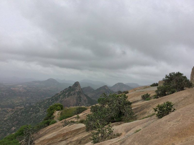
Savanadurga trek
Savanadurga trekking is the highest monolithic treks around Bangalore. It has very steep ascent and the view from the top is awesome. You can also cover Manchanbele dam nearby.
Distance from Bangalore: 50 Kms
Trek Length: 2-3 Kilometers
Level: Medium due to steep climb
Best time to visit: avoid rainy season (It makes rocks slippery) and summer as well
What to see at Savanadurga?
- Fort walls
- Old rock structures
- Big rock walls
- Nice view of Manchanabele dam and surrounding reserve forest from there

Makalidurga trek is famous as a railway trekking spots around Bangalore.
Distance from Bangalore: 60 Kms
Best time to visit: During night and anytime except Monsoon season
What to see?
Rocks, lemon grass, railway track, lakes around the hill etc.

Distance from Bangalore: 30 Kms (Prefer cycling)
Cycling Level: Easy but technical due to lots of ups and downs
Best time to visit: Monsoon season (rest all year fall remains dry)
Note:
Go by Bike or cycling from Bangalore is the best option
Avoid localities, sometimes they misbehave with outsiders
There are broken bottles, chips wrappers and a lot of garbage. So, please avoid littering
What to see at TK Falls?
If you are going by Bannerghatta road, expect greenery; Local Kannada culture on the way
Bannerghatta reserve forest part
Where to eat near TK falls?
Kaggalipura, look into the map (Local traditional dishes available there like Vada, dosa and they are more delicious and tastier than even nice hotels of Bangalore)

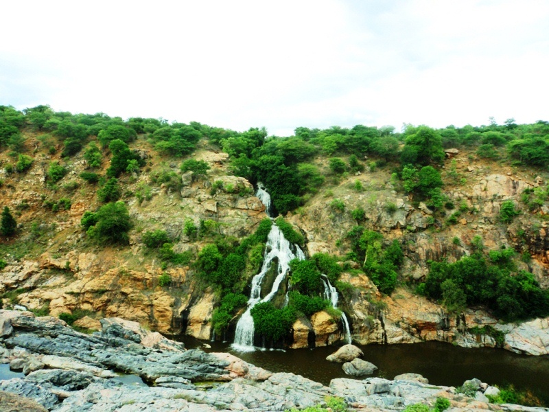
Mekedatu from Bangalore:
Mekedatu always makes to the list of places to visit near Bangalore. To reach Mekedatu, reach Sangama (where river Arkavati meets river Kaveri) and cross the Arkavati river. After crossing the river, you can wait at the other side for forest department bus.
Ticket price: Rs. 50
Distance to Mekedatu fall from there: almost 3.5 Kms
The bus will drop you near the Mekedatu falls. Once you have enjoyed the falls, you can return on any of the forest department buses that keep on carrying visitors to and fro from Sangama.
If you are looking for a weekend gateways from Bangalore then drive to Chunchi falls. Chunchi falls is one of the best places to visit near Bangalore. Chunchi falls is very serene and into nature.
Distance of Chunchi falls from famous cities:
- From Mysore: Around 100 Kms
- From Ramanagara: 55 Kms
- FromBangaloree: 100 Kms
Best time to visit: During and after the monsoon
What can be seen around?
- Mekedatu falls and Sangama
- Kodanda Rama temple
- A calm canal sourcing away from the falls.

How to reach Ramadevara Betta?
Distance from Bangalore: 60 Kms
Distance from Ramanagara: 3 Kms
Drive on Bangalore-Mysore highway; Take the right deviation on Mysore highway after Ghousia college, Ramanagara and follow the road for 2 Km.
Once you reach the base, climb the stairs almost 300 in numbers and then you reach the temple. You can further climb from there. There is a trail to reach to the top or you can ask the locals or priests.
Can I go for night trek there?
We went but in the morning, were caught by the local people and settled sown the matter for Rs. 150 each. You can give it a try.
Best time to visit
Early morning or evening (Avoid rainy seasons, stairs become decisive)
Another places that can be covered from Ramadevara Betta:
- Ramanagara Boating point (Rangarayara doddi lake run by RCUDA)
- Distance from Ramadevara Betta: 10 Kms
- Boating charges: 25/hour.
-
DevrayanaDurga trek from Bangalore, Tumkur
If you are looking for a short one-day weekend gateways from Bangalore, drive to Devrayanadurga. Drive to the top is very scenic and the view from the Devrayanadurga top is panoramic and awesome.
How to reach Devrayanadurga?
You can use Google map and there is a metallic road to the temple. You can go by car or bike. Prefer bike.
Distances:
- Bangalore: 70 kms
- Tumkur: 20 kms
Where to stay?
You can stay at the Tumkur town or nearer to the temple there are travelers bungalow 4-5 km before the temple. if asked, people can help you out there.
Other facilities:
There are small shops over there selling snacks and sometimes lunch too. There is drinking water facility but no bathroom facility.
Tickets & timings:
There are no tickets to the top. The temple is open from 10.00-05.00 pm every day. Abhishekham happens at 11 every day. However, you have to pay for the vehicles.
Other places nearer to Devaryanadurga:
- Namada Chillume (A dear Park almost 7 Kms from there)
- – Sri Vidya Shankara temple (An ancient temple for Sankara Guru).
-
Madhugiri Trek from Bangalore
Madhugiri fort top view

Madhugiri fort trek is another steep trek like Savanadurga, Kabbal Durga trek as mentioned above. This is one of the steepest treks around Bangalore. It also has a lot of spectacular views while trekking up.
Distance from Bangalore: 120 Km
Trek distance: 2-3 Km
Level: easy to moderate
How to reach Madhugiri fort trek?
You can directly to the base of the trek which is the Madhugiri fort.
What to see?
- Temple at the top
- Soldiers barrack at the top
- water tanks
- Fort walls & remnants
-
Nandi Hills Trek from Bangalore

Sunrise, Nandi Hills
Usually, Nandi hills are known for the fort, sunrise and road trip from Bangalore. However, in the recent times, people have started to use the medieval path to the Nandi hills fort as the Nandi hills trek route. There is also a dedicated cycling route to the Nandi hills.
Distance from Bangalore: 90 Km
Trek distance: 2-3 Km
Level: easy to moderate
How to reach Nandi Hills trek?
You can directly drive by vehicle till top
What to see?
- Temple, fort, pond and fort remnants at the top
- sunrise, fog, and nice weather

Siddara Betta trek is situated towards Tumkur side from Bangalore.
Distance from Bangalore: 100 Km
Trek distance: 2-3 Km
Level: easy

ShivGange trek is situated at a distance of around 50 Km from Bangalore towards Dabaspete, Tumkur. Shivgange trek is also called as Shivganga trek. Shivganga is a sacred mountain shaped as a Shiva Linga. There is also a water spring which flows nearby that’s called “Ganga”. By combining these two, becomes ShivGanga.
There are a lot of places to be seen on the peak such as Gangadhareshwara temple, Sri Honnadevi Temple, Olakal Teertha, Nandi Statue, Patalagange, A historical rock statue of Nandi or Basavanna carved on top of a steep rock is considered as a spellbinding sculpture because of its narrow location
Distance from Bangalore: 50 Km
Trek distance: 2-3 Km
Level: easy

Kumara Parvatha trek is one of the most famous trekking places near Bangalore. It is tough but it worths going for the trek.
Details:
There are two trekking routes to Kumara Parvatha:
– From Somwarpet: 1 day; 6-7kms; water falls and streams enroute
– From Kukke subramanya: 2 days; 15 kms; meadows, flowers, greenery, grass lands en route (I prefer this)
How to reach Kumara Parvatha?
Bangalore -(By bus)- Kukke Subramanya -(trek begins)- Bhatru Mane -(en route 3/4 hours)- Sunset Point -( 10 mins en route)- Forest Office (5 mins. Entry: 150 per head) – Kallu Mantapa – Shesha Parvatha – Kumara Parvatha (Destination)
Camping sites at Kumara Parvatha:
Bhatru mane on the way (have advance booking) +91-9448647947, +91-9480230191
Get fresh near common temple washrooms if you get down by 4/5 in the morning by bus from Bangalore.

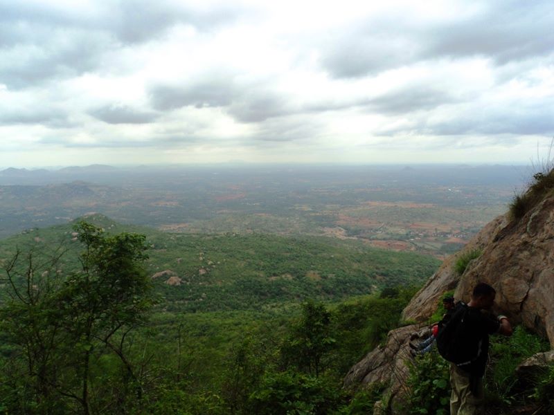
Bandipur highway view
Bandipur national park has turned out to one of the highly recommended weekend gateways from Bangalore and places to visit near Bangalore.
Some Key Info about Bandipur national park:
- Bandipur and Mudumalai national park, Karnataka, are integral parts of Nilgiri Biosphere reserve.
- Nearest town to Bandipur national park is Gundlupet, 20 kms away. From where Jeep can be hired for day safari as well as night safari.
- Forest range officer’s permission is required for camping, elephant safari (available at forest reserve) and for stay at traveler’s bungalow inside national park.
- The national park range office also organizes day and night safari.
- I would recommend open jeep safari at night (though it happens after 3am)
- Don’t forget to take light woolens, nice camera and flash for night safari.
Location: Chikmagalur district in Western Karnataka in Western Ghats
Routes to Mullayanagiri:
- Route 1: You can directly go to Mullayanagiri Shiva temple by your vehicle and start your trek to bababudangiri from mullayanagiri shiva temple peak.
- Route 2: You can trek to Mullayanagiri Shiva temple from Sarpadhari and then continue your trek to bababudangiri. Mark this gate in the photo from where the trek begins.
Sarpadhari and start trek to Mullayanagiri Shiva temple?
From Chikmagalur starts towards Bababudangiri. Near Kaimara, take left turn (8 kms from Chikmagalur). You will see a Y intersection. The road in the left goes to mullayanagiri peak (direct road to the peak ). But, If you want to trek to the Mullayanagiri peak, then move further 500 mts ahead. You will find small arch iron gate to your left. It’s Sarpadhari, the trek starting point. Sarpadhari. Sarpadhari is kannada word which means path like a snake, ‘sarpa’ stands for snake and ‘dhari’ for the way.
You will find a small arch iron gate to your left. It’s Sarpadhari, the trek starting point. Sarpadhari. Sarpadhari is Kannada word which means path like a snake, ‘sarpa’ stands for snake and ‘dhari’ for way.
How to reach Sakleshpur trek?
Sakleshpur is well connected by bus and train from bangalore.
It takes almost 5 hours to Sakleshpur by bus or train.
Go to Anemahal, situated on Bangalore-mangalore highway, is a near by town just almost 4 kms from Sakleshpur and the following route shows you the way to go to railway trek to Yedakumeri after Anemahal.
Where to camp at Yedakumeri?
Sometimes, Yedakumeri station master won’t allow people to stay inside station. So be prepared to pitch your tent on platforms too. So, Carry tent, torch, sleeping Bag and raincoat
Exit route?
In worst case walk back to Sakleshpur (20 Kms) or proceed further to Subramanya road (25 kms same route ahead).
Walking back would be tough after trekking fo around 20 kms from Sakleshpur to Yedakumeri and same applies to proceeding for Subramanya road.
However, Yedakumeri having good frequency of goods train, you can talk with guards of goods trains to help you out till Sakleshpur or Subramanya road depending upon the direction train is going to.
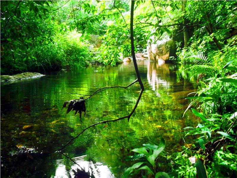
Pristine pool
Nagalpuram trek is not only on the list of trekking places around Chennai but on the list of trekking places around Bangalore as well. Easier accessibility makes it also on the list of long weekend gateways from Bangalore.
Here is little information about what to carry for Nagalapuram trek:
- Eatables like fruits, prepared chapatti, bread with butter and jam
- Enough water though you can get water on the way from natural resources
- Mixing some instant-energy Glucose-D or Tango.
- Lightweight backpack
- Swimming tube (for non-swimmers)
- Dry spare clothing like socks, shorts, t-shirt etc
- And, some favorite personal items like knife, lighter, camera etc.
-
Famous Dudhsagar waterfalls railway trek, Goa
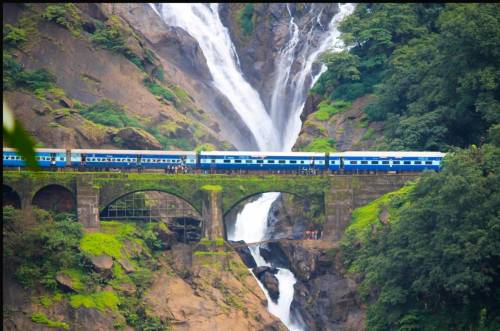
Distance from Bangalore: 570 Kms
Distance from Madgaon: 46 Kms
Distance from Panji: 60 Kms
Trek difficulty Level: Easy to Moderate
Best time to trek : July to Dec (during Monsoon)
Permission: Not needed
Distance between Dudhsagar railway station & waterfall: 1 Km
Dudhsagar trekking routes:
- Castle Rock to Dudhsagar falls (14 kms, 5-6 Hours)
– Most popular route, crowded on weekends, Reach CastleRock from Bangalore by 17311 (MAS VASCO EXP), Only on Friday
– More tunnels enroute; has the famous second largest tunnel enroute. The train track takes a U-turn (refer the map above) and the View point is about 1 km from the waterfall - Kulem to Dudhsagar falls on mud road (12 Kms, 4-5 Hours)
- Kulem to Dudhsagar falls on mud road by Jeep (12 Kms, 1 Hours).
Basic Information about the Tadiandmol trek:
Distance from Bangalore: 275 Kms
Distance from Mysore: 135 kms
Distance from Madikeri: 35 Kms
Trek starting point: Nalknad Palace (4 Kms from Kakkabe Town Market)
Trek difficulty Level: Moderate
Tadiandamol trek distance: 8 Km (one side)
Tadiandamol peak height: 5700ft
Time to trek: 6-8 hours on average
Camping site: At the foothills of the peak( a huge rock from where the path gets steeper)
Best time to trek: September to Feb
Permission: Not Required
Trekking fees: No charges

Monsoon survival trek, Nishani Betta, Niligiris
How to Reach Nishani Motte?
Bangalore -> Mysore -> Madikeri -> baghamandala (Take forest department guide) -> Talacauvery (Trekking begins) -> Nishani betta (almost 12 KMs) -> return to APC (Anti poaching Camp for over night stay) 3 Kms-> Back to Baghamandala next day Guide charge: Per head Rs. 200 + permission Rs. 500
Contact Person from forest department: Mr. Uthhappa (09448108280)
What to carry on trek?
- A nice trekking shoe
- A light and strong backpack.
- Extra pair of clothing packed in garbage bags to make it rain proof.
- Tents, Sleeping bag and sleeping mat (optional) (personal)
- Toilet paper, mouth wash, hand wash
- Water bottles (at least 2 liters each), energy drinks ex glucose/ energy bar/electrolyte
- Wind- cheater & warm inner
- Personal camera, Torch, Mobile & sufficient battery backup
- ID card, sufficient cash and emergency contact info (personal)
- Iodex spray, cramp bandage & personal medication
- petrol (for making fire) and matchbox/ lighter (shared)
- lightweight utensils, disposable cups & plates. eatables to cook up there
- slippers to roam around at top (personal), salt/ snuff powder to avoid leeches.

Where to stay in Gandikota?
You can sleep in the Granary beside the Jamia mosque. The granary is kept locked during the day but after the sunset, a guard or you can say the curator, settles in there. If asked, he allows people to sleep in the granary.
When we went, we had planned to pitch our tent at the canyon cliff but it began raining and we had to take shelter inside the Ranganathaswamy temple. There is also tourist bungalow near the entrance of the Gandikota fort. I don’t have much idea about their pricing and facilities.
Bathroom facilities:
There is no bathroom facilities inside the village or near the fort remnants.
Other facilities:
There are a few shops at the entrance of the fort and one or two basic type shops in the Gandikota village where you can get regular stuffs.
How to get down to the river Penna?
To the east of Ranganathaswamy temple, a main water pipe goes into the river. Along the water pipe, one can go to the river or its better to ask the villagers.
Nilgiris trek
About the Brahmagiri trek:
Location: On the border of Kodagu (Coorg) district in Karnataka and Wayanad district in Kerala
Distance from Bangalore: 300 Kms
Trek starting point: Thirunelli forest guest house in Kerala
Trek difficulty Level: Easy to moderate
Accommodation: At Thirunelli at KTDC resort
Total trek distance: 6 Kms (One side)
Brahmagiri peak height: 5276 feet
Time to trek: 4 to 5hours (one side)
Camping: Not allowed
Best time to trek: Post monsoon.

Location: In Chikmagalur district of Uttara Kannada, karnataka
Distance from Bangalore: 333 Kms
Trek starting point: Mullodi village (15 kms each from the town of Kudremukha/ Kalasa)
Trek difficulty Level: Moderate
Total trek distance: 9 Kms (One side)
Kudremukh peak height: 6050 feet
Time to trek: 4 to 5hours (one side)
Camping: Not allowed
Best time to trek: Mid sept to mid feb
Permission Required: Yes
Trekking permission fee: 275/ person
Accommodation (base camp) and food Rs 600 per person
Jeep charge 500-700 per group (max of 8 people) drop from Balegal to Mullodi.
About the Chembra trek:
Location: In the southern Wayanad district in Kerala
Distance from Bangalore: 300 Kms
Trek starting point: Chembra foothills tea garden
Trek difficulty Level: Easy to moderate
Accommodation: Kalpetta / Meppadi (around 20 Kms from Chembra)
Total trek distance: 3.5 Km (One side)
Peak height: 6000 feet
Time to trek: 2 to 3 hours (one side)
Camping: Not allowed
Best time to trek: Post monsoon
Permission: Needed
Trekking time: 7 AM to 2 PM (After 2 you won’t be allowed to start trek)
visiting time: 7 AM to 5 PM (You can latest return by 5 from the peak)
Guide: Given at the VSS office
Entry fee: 20/ person
Guide charges: 150.

Height of the peak: 4406 feet
Nearest town: Kollur
Difficulty level: Moderate
Number of routes to the peak: 2
Time to trek: 4-5 hours
Camping site: Near Kodachadri Information bureau/ PWD house at the peak
Best time to trek: September-March
Permission: Not needed
Trekking fee: No
Guide: Not needed
Contact information:
Kodachadri temple priest: 09632847302
Rajendra (trek guide & accommodation): 09449145540
Santhosh Hostel: 08185290183/ 094838116911

Trek Length: 8 Kms
Trek Time: 6-7 Hours
Distance from Chennai: 90 Kms
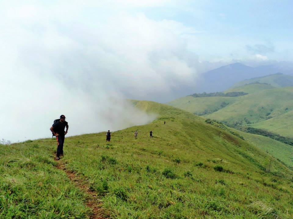
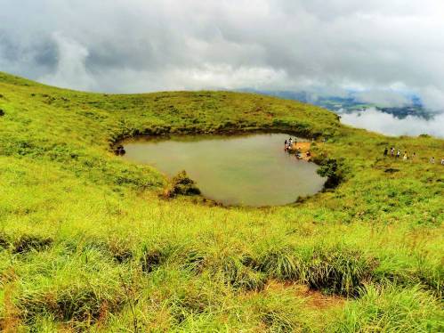
A boon companion of Western Ghats, in recent years, has earned the reputation of being a mystical land full of hidden beauty and the more you explore the more beauty it reveals. The belief of finding a paradise in the parched plateau seems as tough as convincing a girl for not to go for shopping but once you step in, you have to see it for yourself.

About the OG Trek:
Get down at the Gundya forest check post; Start walking towards Mangalore (The direction opposite to in which you came from/ Continue ahead) on the same road NH48 till a bridge called Kempu hole (name of the river) to reach the Jeep track. almost 2.5 km on the way (30 min walk)
Trek length: 24 km (8 hours up te hill and 2 hours down the hill)
Trek difficulty level: Difficult
Height: 3236 feet
Get fresh at Gundya forest check post
Camping site: Grasslands on the way
Permission: Difficult to take (Trekkers sometimes venture inside without taking permission).
if you are a trekking lover you gonna love this blog post. he has mentioned very nice Trekking places around Bangalore which is safe as well as adventurous.
visit our site to know more about Top Attractions in Bangalore
Very interesting and informative post.
Last time when I had visited Bangalore, a friend of mine randomly planned a morning drive to Bheemeshwari, and picked me up in his car – it was a jolly ride and we spent some great time over there – we didn’t go trekking – we just enjoyed, so i’d definitely recommend that spot for those who’re new to Bangalore. I also found a great list of weekend’s getaway from Bangalore, and a great travelogue on Pondi on this blog –
Hey
Great blog with interesting info! Totally an inspiration.
I just started blogging and would love your input on this – http://trekkingplacenearbangalore.com/
Do you make all treks solo or with any organizing group?
Mostly solo nowadays… but I organize as well.
Very good info.. pls keep updating this post.
Request the writer to update the details as some of these have been banned by the Forest Dept recently. Eg. You can no more trek the Savanadurga mountain.
Surely, we will update it
Thank you very much for sharing…
awsmm
Nice collection………useful information for all of us.Thanks for sharing
Also visit @ http://letzstepout.com/
very intresting
Thanks a lot 🙂
its very helpful
Thanks satish 🙂
For more details here you go…
http://heavenlykarnataka.blogspot.in
There are very nice Trekking places around Bangalore which is safe as well as adventurous. To name a few are,
Savandurga
Skandagiri
Ranganatha swamy Betta
Anthargange
Ramdevara betta
Shivagange
For more details please visit,
http://top5placestovisit.blogspot.in/2014/01/top-5-treks-around-bangalore.html
Great overview…!!!
found an useful post after long time… nice and keep it updating…..
nice collection.certainly helpful.
You’re a trekking website how can you not have time taken to trek from base to top?
Hi,
Details have been given in each particular trek.. Kindly click the link to know about other trek details….